Notice: Use of this site constitutes your acceptance of these Terms of Use.
University of Tarafu Document 99-006-0861
See notes below document.
Notes:
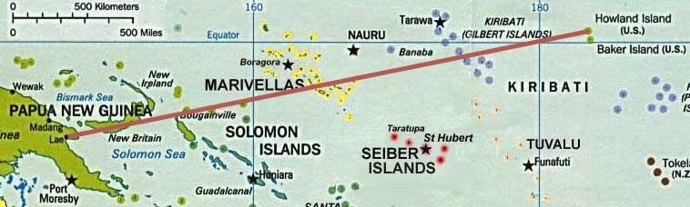
1. This document is a map showing what Amelia Earhart's flight path would have been if she had flow directly from Lae, Papua New Guinea to Howland Island.
2. Not shown on the map is Truk Island (lying approximately 1000 miles north north west of Lae) which some scholars believe Earhart flew to as part of a secret espionage mission.
3. Also not shown on the map is Krebs Insul which lies east of the Marivellas and north of the Seiber Islands according to Professor Klaus Werner Immerschreiben.